Kotor


Despite the gale force winds, the flash flooding and the expected tornado, it didn’t take long for Montenegro to be my favourite country in the Balkans. We set up camp in a spacious AirBNB in Kotor for a whopping $35/night. It was smack in the middle of old town, two floors above the noisiest nightclub I’ve ever witnessed. If you think about it, Montenegro had a lot going against it: it stormed, it flooded, and we had sleepless nights listening to the booming base of remixed 90’s top hits. And yet it didn’t deter from the country’s wonderful allure. 

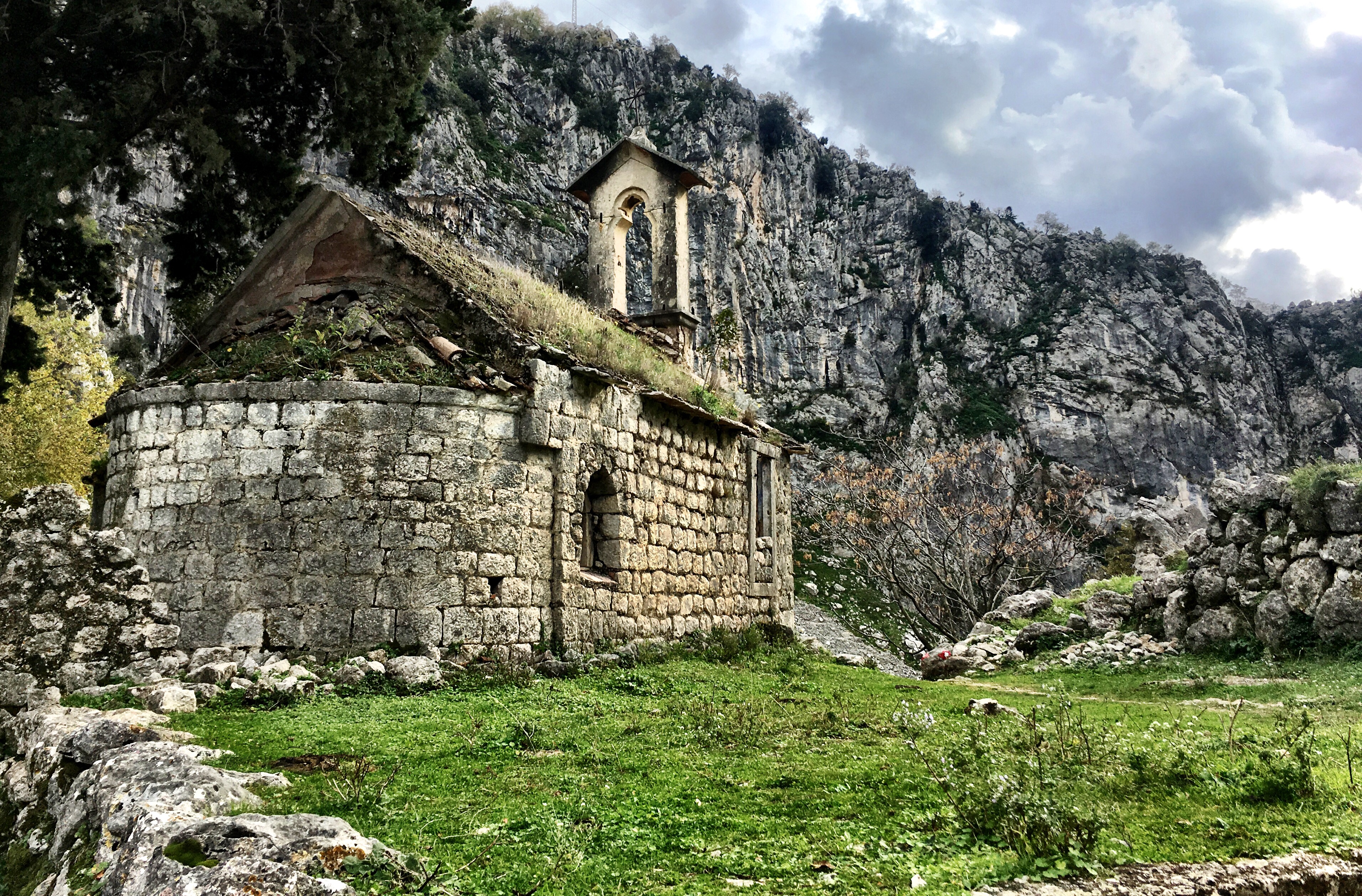
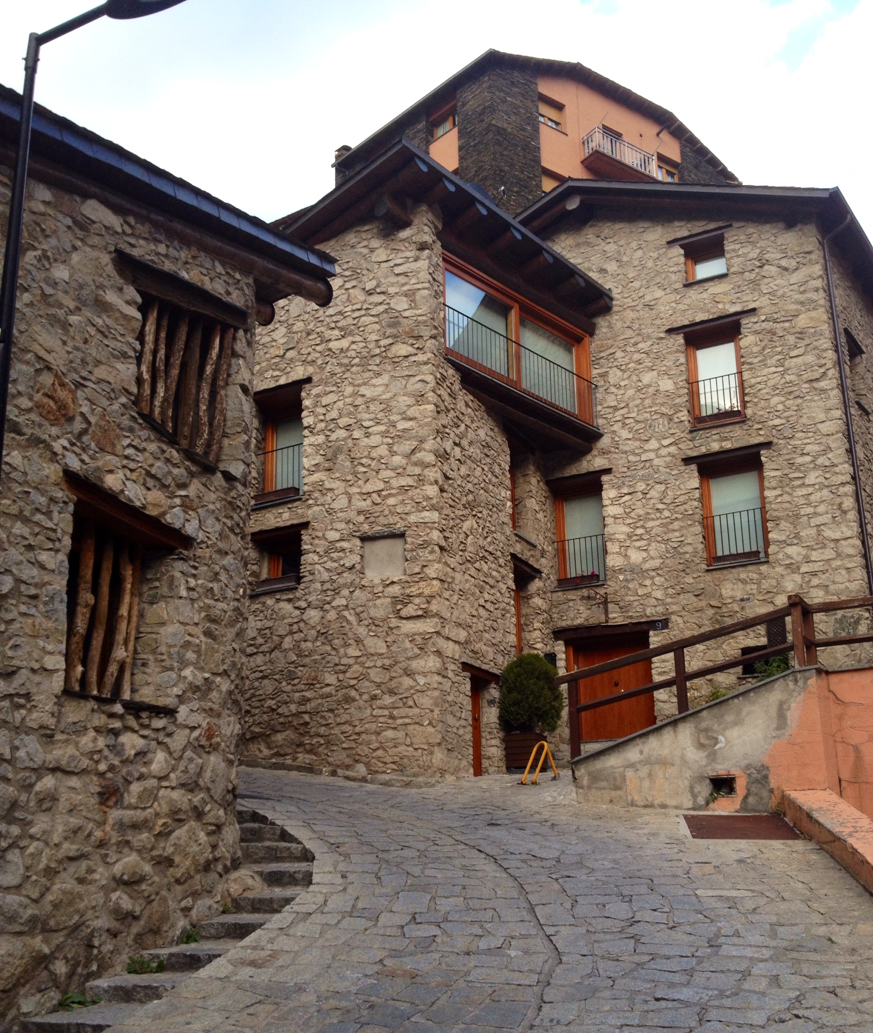
The Old Town of Kotor never failed to surprise me. Four days of wandering the labyrinth of slinky alleyways and we never saw it all. Every time we left our apartment we stumbled upon a new courtyard, a medieval palace, a church we had missed: the city had gems around every corner. Though it took only 20 minutes to walk the circumference of the city walls, I never tired of the place. 

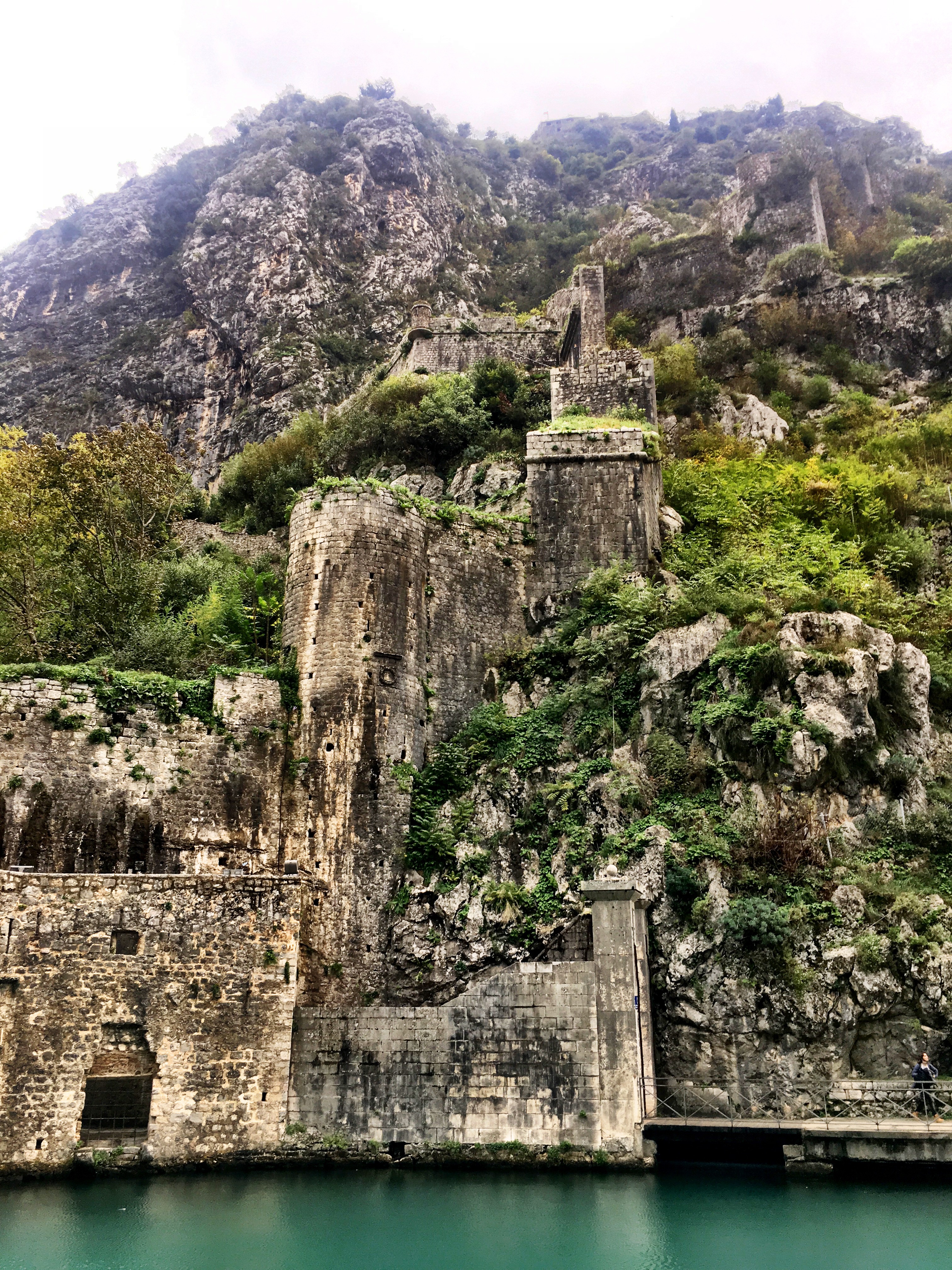
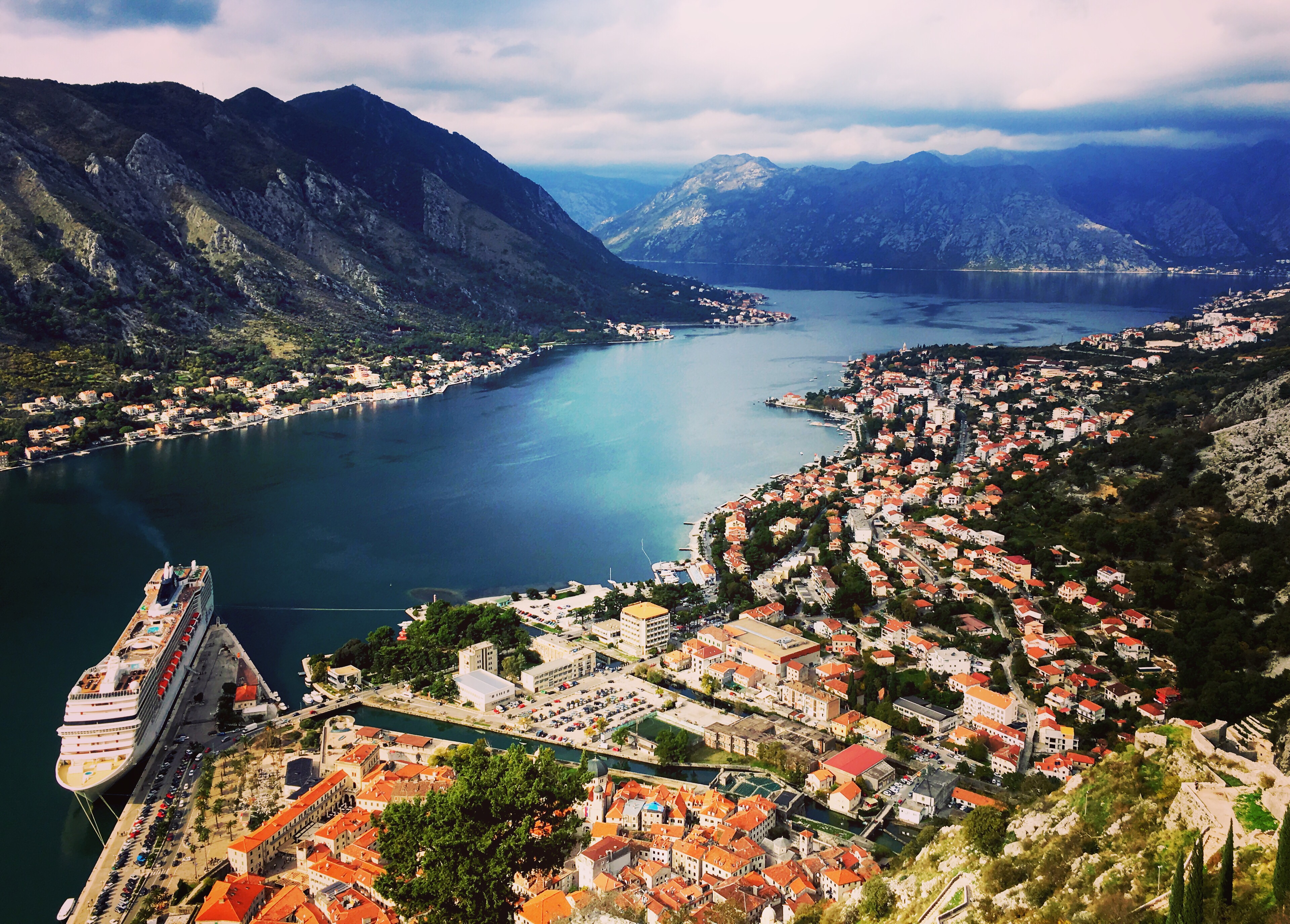
Kotor is set in a crevice at the end of a long inlet: sharp black mountains ominously behind it. The ruins of a fortress stand high above; a reminder of the city’s ancient history. The remains of old fortifying walls cling to the cliffs behind the old town, and at night, the whole place comes alive in a golden glow of artificial light. 

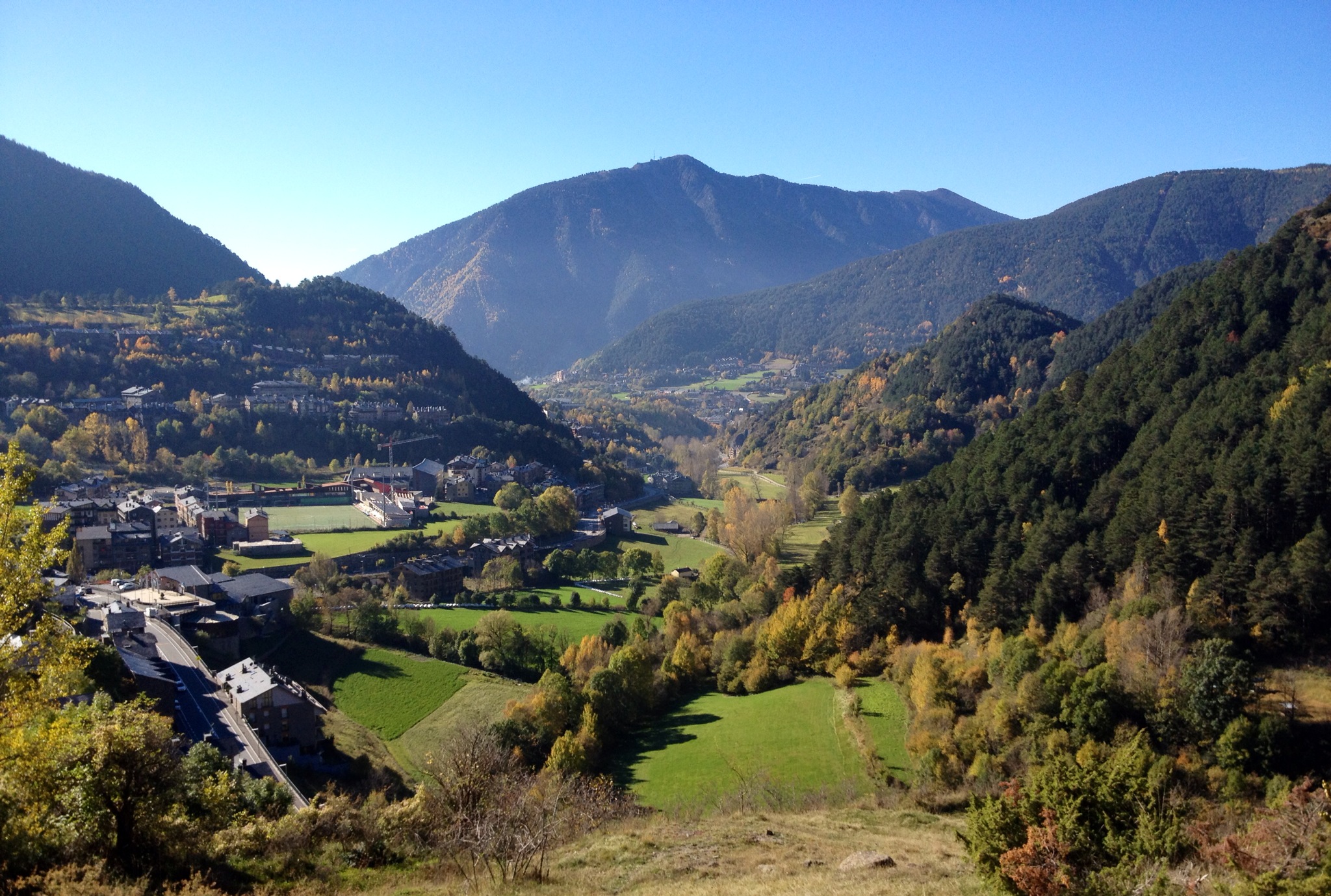
We spent the better part of our one rainless afternoon climbing the steps of the old empire. The view from the mountain looked across the windy Bay of Kotor. A white cruise ship towered above the old town; dark mountains swept down to meet the black water that meandered out to the Adriatic Sea. Kotor is stunning. 

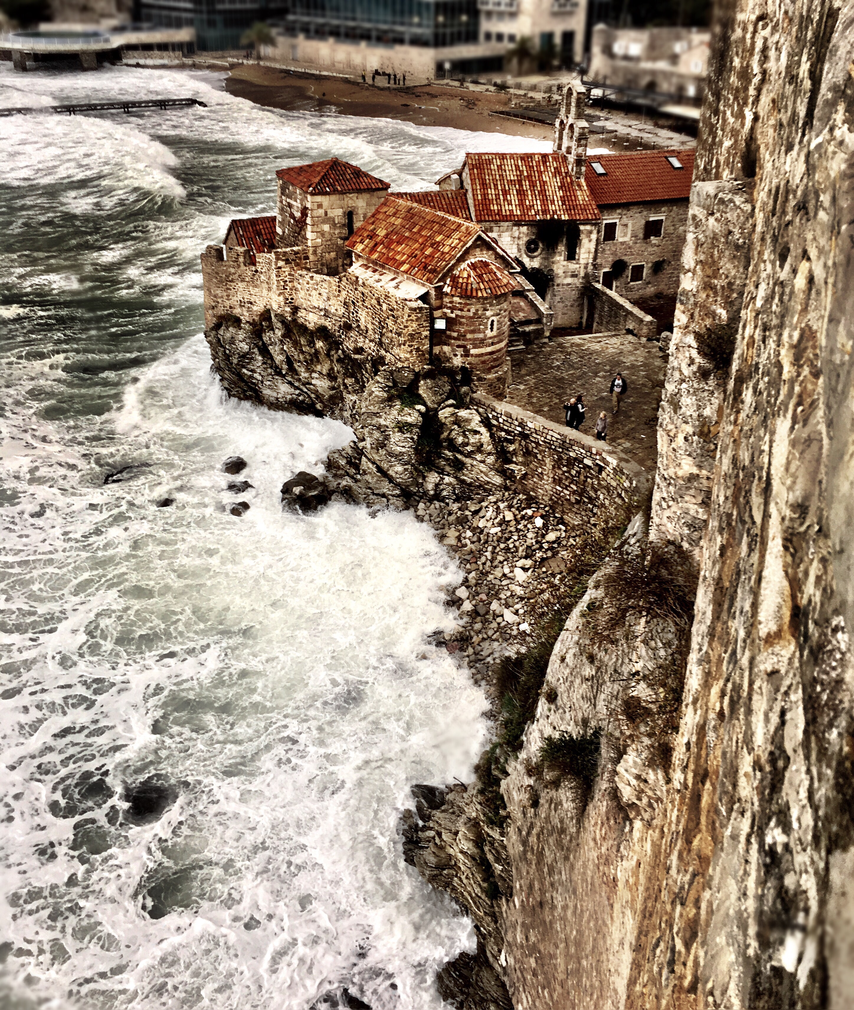
We used Kotor as our home base for exploring the nearby region of Montenegro. Although our tour inland was cancelled, we had no problem exploring the coastline on our own. Budva, is a small resort town just 30 minutes from Kotor. At over 2500 years old, it is one of the oldest settlements on the Adriatic Coast. The walled old town was built by the Venetians as a defence against pirates. This was particularly exciting to Jodon and I since we are half way through “Black Sails” on Netflix and menacing pirates have been fresh in our minds. The storm hit as we explored the city. Huge waves crashed on the white sand beaches. Some of the swells were so large they splashed over the city walls, nearly soaking Jodon and I as we ran along them, through wind and spray, toward safety. We ate lunch inside the walls and listened to the rains outside, happy for the warmth and shelter. And miraculously, once we had finished, the skies cleared up enough for us to make our way home. 

The next day we set out to Perast, a sleepy town just 15 minutes North of Kotor. It was our anniversary, and I couldn’t think of a better way to spend it. 

Perast is made up of only two streets. There’s a small museum, a clock tower and a number of cosy seaside restaurants (all empty due to the off season). We hardly saw another person the entire afternoon. 

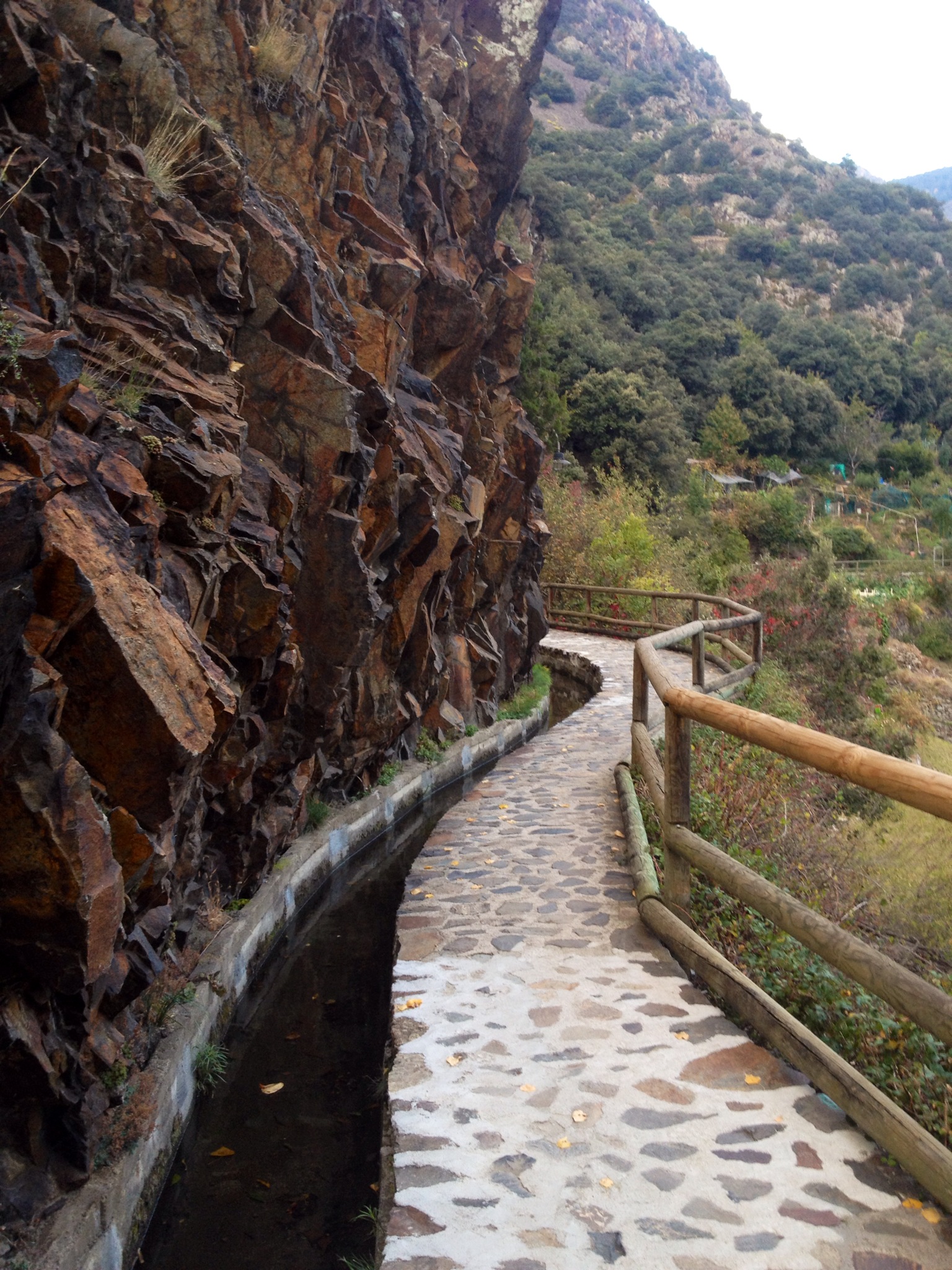
We walked along the boardwalk from end to end (about a 10 minute walk). It was cool, and the clouds threatened rain all afternoon, but the row of tall palm trees along the water suggested this place got much hotter in the summer months. We were lucky enough to have the sun come out long enough to explore the tiny islands just off the coast.

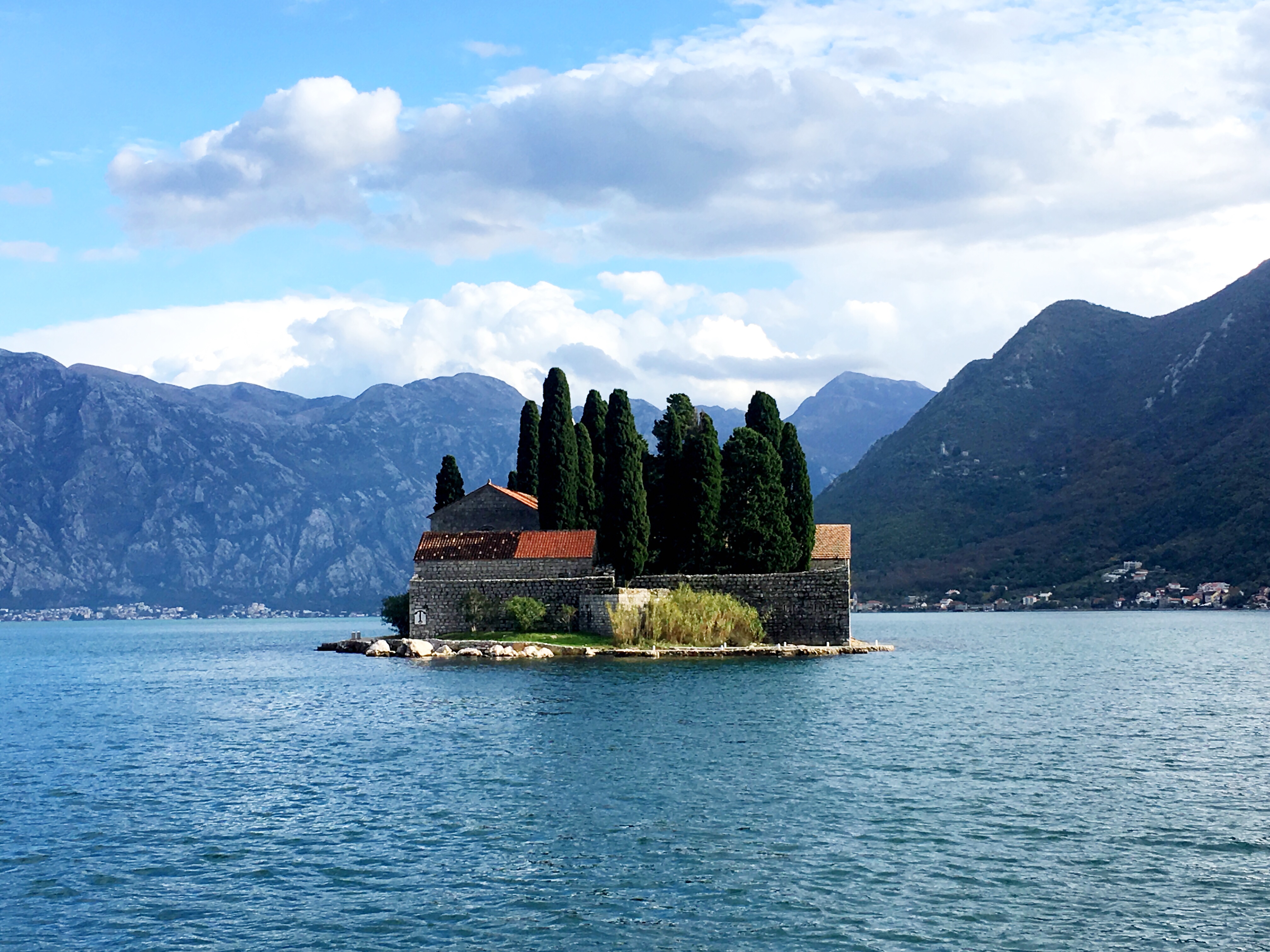
There are two small islets just off the coast of Perast: St George and Our lady of the Rocks. Although the former is a private island, Our Lady of the Rocks is open to both tourists and locals alike. The island is tiny: just large enough to fit the small church with a museum attached. A woman working in the church was thrilled to tour us around and give us the history of the place.

It is said that, in the 15th Century, local fisherman stumbled upon a painting of Madonna, perched upon a rock in the middle of the bay. Locals took this as a sign that a church needed to be placed in this spot. So over many years, rocks and earth were brought to this place in the bay to eventually create a small island. Soon after, a church was erected and the original painting was hung above the altar inside: it still sits there to this day. The church was believed to bring great luck to sailors in the area. Survivors of shipwrecks thanked Madonna for watching over them, and in return for their lives, donated a painting of their sinking ship to the church. The museum on Our Lady of the Rocks now holds countless numbers of shipwreck (or near shipwreck) paintings, each one from an actual event where sailors’ lives were spared. 

The little church is still used today for Sunday mass (weather dependant of course) and even while we were there, a few locals came in to pay their respects to Madonna.

The rains arrived in full force as we arrived back in the old town of Kotor. The streets began to fill up with water, and by the time we ventured out for dinner reservations, we were wading ankle deep in a rushing river. As a result, we were the only people who made the daring venture to Galion, a steak and seafood restaurant just outside the city walls. We arrived looking like drowned rats; our clothes completely soaked from the rain. But it was still a wonderful evening, drinking wine and watching the storm from behind the floor to ceiling windows in the cozy restaurant. It was our last night in Montenegro. The next morning we would hop on the early bus and make our way South to Albania.

Valle D’Incles and Andorra’s Largest Lake

“It’s not in the hiking pamphlet,” said the man at the information center, “but in my opinion, the Valle D’Incles is the most beautiful area in Andorra.” He scribbled a circle around a little river in the North East corner of the country map. “If you’re looking for a nice easy walk, and you don’t have a car, it’s only 1 hour, each way, through the valley along a road and it’s one of my favourites”.
I was really excited about exploring the valley, but a 2 hour hike didn’t seem worth staying an extra day for. So I looked up hikes in the area through the Active Tourism app. Sure enough, at the end of the valley, there was a popular hike that was 2 more hours, each way, to lake Juclar.
Lake Juclar is pretty much right on the France border in the parish of Canillo, and is Andorra’s largest lake! The photos looked great, so I decided to do the valley and the lake in a combined 6 hour hike.
According to the app, it didn’t look so hard, after all, it only climbed 500ft in altitude, how bad can it be?
When my alarm went off before the sun rose, however, I had different opinions on the matter. Even under the layers of blankets in my hotel room I could feel the cold outside. I did not pack for cold weather. I always forget to pack for cold weather, despite knowing that I’m ALWAYS cold, even during the summer months. I also didn’t pack for hiking. I only planned on MAYBE hiking for one or two days during the two months I was away. Not really worth hauling boots around for. So instead, I looked ridiculous throwing on my tights and my toms to go out for the day.
The bus driver thought I was crazy when I told him what stop I wanted him to drop me at.
“But why? There’s nothing there…”
“For hiking!” I said, a little too enthusiastically for how I felt that early in the morning. He looked skeptically at me, but shrugged and kept driving.
When my stop came up, the driver pulled over on the side of the highway and nodded for me to get off.
“Gracias” I smiled. Proud of myself for trying something a little more off the beaten track. And I strolled off the bus with confidence.
But as soon as the bus was out of view my confidence left me. I was in the middle of NOWHERE! I was standing on the side of the highway, in the 6th smallest country on Earth, stuck right in the middle of a mountain range. And it was freezing. It was absolutely freezing. Tights were definitely a mistake.
I quickly found the little side road that would take me through the valley and started at a brisk walk to try to warm up. But the sun looked like it was hours from hitting the area, so it was much more of an effort than I expected. For the first ten minutes I had my face down in my scarf and my hood pulled so far over my head I didn’t see any of the scenery. But then I remembered this was supposed to be the most beautiful area of the country and I forced myself to pay attention.
The valley was gorgeous. Perfect little stone homes scattered the valley, with cows grazing in the pastures outside. A small river ran right through the valley, all the way to a larger mountain that stood at the end of the road. I assumed that’s where I was headed.
The walk was wonderful, and easy. It was paved, and I didn’t feel like my pathetic excuse for walking shoes were out of place. And it wasn’t an hour later before I reached the end of the road and found a few signs for walking trails in the area. One that read “Juclar” pointed up a small hill along a rocky path. Well that must be it!
Since the sun still hadn’t made it to the valley, the path was icy. The water that had run from the stream onto the trail had frozen overnight and made for some slippery terrain. Oh great, good thing toms have such a wonderful tread on them…
As I started my ascent I looked around for where the path might be going. I must follow along another valley somewhere if I’m only ascending 500ft, but all the areas pointed to up: way up. About ten minutes in a thought occurred.
“It’s funny that the app would list the elevation difference in feet when everything around here uses the metric system…” Then I stopped. Pulled out my phone and rechecked the app. Yup. I was right. It wasn’t 500ft, it was 500m, or 1500ft in elevation change… Oh my god.
Well I’d come this far, I might as well continue. So off I went. I climbed up and up and up until my legs were burning. And every time I made it to the top, there was another peak to climb. That rumour about the 7 false peaks of a mountain… Yeah, that’s a real thing.
Luckily for the mountain, the views were all worth it. During my two hours of hiking upwards, the sun still hadn’t reached me. Which now that I had seriously warmed up, was a welcoming fact. But looking back down the path I’d just climbed, despite looking into the shadows, was spectacular. It really made me and my toms and my tights feel accomplished!
And to top it off, the app was bang on. Exactly 2 hours and 10 minutes later I had made it to the end of the path. Exactly the time it had quoted. And I had made it to the country’s largest lake!!!
As I stood at the top of the mountain, looking down at the lake I had to laugh. Coming from Canada I think we have slightly different views on what “large lake” means. Not that the app ever stated it was a “large” lake, but instead the “largest” lake. Still, I think I had envisioned something larger. I’m pretty positive that some celebrities have swimming pools the size of Andorra’s largest lake. Not that I’m judging.
But since the climb had been such an accomplishment, the lake was one of the best things I’d seen all morning! So I climbed down the rest of the path: over a pile of boulders from a previous rockslide and down the edge of a cliff with a rope that had been provided by someone. And I sat down on the rocky shores of the lake. Well to be fair, it was two lakes, side by side, that probably meld together during the rainy season. I took off my shoes and dipped my toes in. The water was glacial! Not that I had ever anticipated wanting to go for a swim, but at this time of year and at a couple thousand meters in altitude, I don’t know how anyone would want to go swimming. On the other hand, I’d reached the sun! So I sat down for a picnic lunch and reveled in the scenery! There was a cabin at the edge of the larger lake that was a year round guarded cabin (these are fairly common on hiking routes in Andorra). The first two people I’d seen on the trip were two men surveying the area around the cabin. About a half hour later a French couple, decked in full out hiking attire passed by me as well. Otherwise, the area was pretty much empty.
After lunch I started my slow descent back to the Valle D’Incles. The sun had come out in full force and I went quickly from four layers of clothing to one. It was a little less than 2 hours to reach the bottom and a further hour to make it back to the main highway. Instead of hopping on the bus right away, I walked another half hour to the closest town to check out what very, very rural Andorra looked like.
The tiny, 3 road village of El Tartare, albeit just as gorgeous as the rest of the country, was completely shut up for the off season. So I jumped back on the next bus to Andorra la Vella and called it a day. The Pyrenees will definitely be seeing me again!

IMG_0838.JPG

IMG_0921.JPG

IMG_0848.JPG

IMG_0850.JPG

IMG_0920.JPG

IMG_0888.JPG

IMG_0888-0.JPG

IMG_0899.JPG

IMG_0917.JPG

IMG_0916.JPG

IMG_0918-0.JPG

Andorra La Vella

As I drove out of Spain and over the Pyrenees into Andorra I had a sudden realization: I have no idea what language they speak in Andorra. Spanish? French? A language all of their own? Not a clue.
I decided to come to Andorra based entirely around one thing: a google image search. I typed in “Andorra” and a beautiful photo of Andorra La Vella, nestled in a valley popped up. I was sold. That was the entirety of my research on the country…
But as I stood in the lobby of my hotel, staring blankly at the receptionist, mouth agape and yet not saying a word, I felt like I should have done a little more homework. It was an awkwardly long pause as I waited for the receptionist to speak first, anything to give me a hint of what language I should say hello in. The street signs were unhelpful, there were minimal people chatting in the streets, and then I found myself in the lobby, not knowing what to say.
“Adeo” said the receptionist finally. Amazing! They speak Catalan! It wasn’t that amazing, since “adeo”, meaning “hello”, was the only Catalan word I knew. But at least I was getting somewhere.
Then before I had time to answer, she followed up with “ca va?”
Oh no. Maybe it’s French they speak! Once again, my conversational French is limited to basic greetings, so I decided to respond in English.
“I have a booking” I said with a smile. She stood and looked at me with a confused face. Clearly English wasn’t one of the languages they spoke here. “A reservation?” I tried again.
“Ahh! Si! Por su puesto!” She answered in Spanish, and then grabbed the reservation book. I was utterly confused. Three sentences, three different languages. I still didn’t know what they spoke here. So when I had been successfully checked in, I sheepishly asked in Spanish “this may be a stupid question, but what language do you speak here in Andorra?”
She laughed “Spanish, French, Catalan, it doesn’t matter!”
And that was that. For the next three days I was greeted with a mix of “ca va” “hola” “bonjour” “que tal” “adeo” the three languages were used almost interchangeably. Lucky for me, I could get by on basic Spanish.
My hotel was located right smack in the middle of the capital city. But seeing as it took only ten minutes to walk from one side to the other, and the population is only 22000, it felt more like a town than a capital. Regardless, the city was gorgeous. It was a stereotypical ski village: curled up in the mountains, stone chalets scattered among the hills, and a crisp Fall air. It was like Banff or Jasper with zero tourists. October is a VERY off season in Andorra. With no snow for skiing and little sun for hiking, most people avoid the little country this time of year. But the days I was there were beautiful: sunshine all week! Crisp mornings and warm afternoons. Autumn was just beginning, the leaves had begun to change, and the city was gearing up for the winter months. A man in the streets was celebrating the winter cheer early by LITERALLY roasting chestnuts on an open fire in the middle of the main square.
I spent a couple days in Andorra La Vella walking the upper paths that lie behind the city along either mountain. It’s a 10 minute hike straight uphill, but then a cobblestoned path runs flat along the entire length of the city. It was a popular route for locals heading home: many people had small homes with large vegetable gardens stretching all the way up the hill; the agricultural center of Andorra. It also had spectacular views of Andorra below. All the locals greeted me as I passed by. Everyone was ridiculously friendly.
After my city exploring, I went to the Information centre for some pointers on good hiking spots around the country. The man at the desk was so helpful and so enthusiastic about his country, I actually changed my itinerary to stay longer so I could fit it all in. I went back a few days later to thank him for his recommendations and he was so thrilled it looked as if he was going to cry. He even came out of his little hut to hug me goodbye and said he would have many more spots to suggest next time I visited.
I couldn’t take enough photos of the city, around each corner there was a new adorable little building with a dramatic mountain backdrop. Each time the sun moved I felt like I needed to hike back up to the walking paths for more panoramas. I loved it.
Then on my second day in the country I visited Ordino, a smaller village a half hour north of Andorra La Vella, and I was even more blown away. According to the guy at the information center, Ordino was the most beautiful town in all of Andorra, and I believe him. Most of the shops and restaurants were closed for the off season, but it didn’t take away from the beauty of the cobblestone streets and winding walkways. I spent the day hiking through the hills around the area. My discovery of the Active Tourism Andorra app was a life saver! It listed hiking, skiing, and biking routes all over the country. It grades them on difficulty, gives you a map, and if you’ve got 3G (which I sadly did not) it will follow where you are on the map and find the path for you if you get lost. It was wonderful, and I was able to find a tonne of little trails to explore. I was so happy about my day in Ordino that I decided to stay another day to hike the other areas I’d been recommended! And if I didn’t have other places to be, I could see myself easily getting stuck there…

IMG_0703.JPG

IMG_0702.JPG

IMG_0716.JPG

IMG_0725.JPG

IMG_0728.JPG

IMG_0731.JPG

IMG_0749.JPG

IMG_0764.JPG

IMG_0759.JPG

IMG_0826.JPG

IMG_0768.JPG

IMG_0812.JPG

No Wine in Wineglass Bay

20140816-151753.jpg

Okay… I have to admit. This post is SO beyond due. I’m terrible at keeping on track with my blog posts, and the more fun I’m having on a trip, the less I want to spend time writing. But better late than never I suppose!
During my Australia trip I managed to hop down to Tasmania for a week to visit my old pal Mark. Remember Mark? I met Mark and Ollie two years ago while traveling through the Bolivian Salt flats with Adam (see previous posts from Bolivia). Well, two years ago Ollie bragged than Mark cooked up “THE BEST” lamb in the world.
“Well you should make some for us!” Adam and I exclaimed.
“Well you’ll have to make it all the way to Tasmania and then I will!”
So that’s what I did…
Little did Mark know, I made the trip half way around the world just to try his lamb recipe. And I have to admit… It’s the best I’d ever had! (Well done Mark).
My trip to Tasmania was awesome, and I have enough stories to fill another 20 posts if I had the time to write them all. One of my most memorable however, was our trip to Wineglass Bay…
So here you go!

It was a two hour drive from Hobart to Coal’s Bay Saturday evening. Mark and I stopped for a wallaby salami and brie pizza on the way up (and on the way back it was so good) and arrived an hour or so after dark.
“You’re probably going to see lots of road kill on the drive up” Mark explained to me as we started our road trip. He wasn’t lying.
As we approached dusk, it seemed every couple hundred meters there was another flattened animal on the road. Wallaby’s, possums, a rabbit maybe… It was hard to tell with some. Sadly, we added to the stats only 20 minutes from Coal’s Bay, as we squished an unsuspecting possum around a sharp bend!
“There was no escaping it!” I said as Mark gave a sad face after hitting it full on. We decided the next day it was our sacrificial rain possum. We managed to pick the absolute best day of the trip to hike on. Couldn’t have been coincidence with my weather luck this trip… Had to be the sacrificial possum!
We stayed at Mark’s friend Cat’s cabin up in Coal’s bay. The little getaway was aptly named “Utopia” and it was just that! An adorable little home right on the edge of the water tucked away in a quiet bay. The place had a fireplace, multiple rooms to sleep in, comfy couches and a backyard with a picnic area! Pretty amazing.
We had an early night to get some rest before a long day of hiking. Just around the corner from Coal’s Bay, in Freycinet National Park, was the stunning Wineglass Bay! I had seen photos of it months earlier and instantly it was on my list. A secluded stretch of white sand and sparkling turquoise waters, bring it on!
“So do you know why they call it Wineglass Bay?” Mark asked me the night before.
Multiple answers ran through my head: because the waters sparkle like champagne? Because the bay is shaped like a wineglass? Because there’s vineyards all over the mountain and they serve free wine? Because there’s an exquisite wine bar on the beach that you can relax at after a long day of hiking?
“No, why?”
“Because they used to herd whales into the bay and slaughter them there. The bay would then fill with blood, making it look like it was full if red wine”
…I sat there with my mouth open in horror.
“What?! That’s the reason?!”
“Yup, sorry to disappoint.”
“So there’s no wine?!”
Perhaps I should have looked up ANY kind of facts on this trip. But then I would look like I was “planning” on my otherwise totally fly-by-the-seat-of-your-pants trip, and we couldn’t have that. Still, I was not thrilled that there was no wine in Wineglass Bay!
Luckily however, the day was beautiful, so no amount of whale murdering was going to get me down on the views. A day of hiking, here we go!
Mark insisted that we not only hike the 3 hour return saddle to the bay and back, but we also hike the totally separate 3 hour Mt. Amos trek as well. I’m not a huge hiker, and 6 hours seemed slightly daunting at first. But how bad could it be?
We started with Mt. Amos. The first 15 minutes were a wonderful leisurely stroll through the woods. We saw a couple lizards, I could chat while we walked, and our gradual incline was exactly how I liked to hike!
Then we came upon our first sign: “Warning. The rest of this hike is very steep and has rough terrain. Do not attempt in wet or slippery conditions.”
Great.
Nothing is easy.
And the sign didn’t lie! The path got MUCH steeper from then on in. In fact, “path” might not be the right word. More like “marked off direction”. There was no path; there were just steep rocks that you had to scramble over and climb up. Way up. To the top of the mountain! But an hour and ten minutes later we pulled ourselves over the last boulder and made it to the top.
“We did it!!” I cheered.
Retrospectively it wasn’t as bad as I thought it was going to be. It was tough, and uphill, and I love to complain while I hike, but the views were worth hiking twice the distance! (And by that, I mean I would have given Mark my camera and he could have hiked it for me)
Wineglass Bay is stunning, and Mt. Amos has by far the best views of it. As many times as I said “damn you!” to Mark, I’m glad he made me hike it.
We stopped for some photos, a little snack, and then a half hour later started our slow decent (mostly sliding down on our bums) back to the bottom.
It’s frustrating really, that you have to come right back to the starting point from one hike before heading out on the next. Why couldn’t we just walk straight down from Mt. Amos to the bay?! Now we have to hike halfway back up the mountain to get over the saddle and once again down towards the bottom!
But the second three hour hike was much easier. The path was cut out and graveled, the ascent gradual, and we ended up right at the water!
The tropical looking waters of Wineglass were a little deceiving. The day was scorching, I was drenched in sweat, and the most incredible thing would be to jump in the ocean for a swim. But one toe in the water sealed that deal…
I’m not one for cold water to begin with, but this was freezing! No wonder only two people out of the hoards we saw down there were brave enough to take a dip. A shame really, no wine AND no swimming! What kind of a place is this?!
But it was hard to complain when we sat in the shade with a picnic lunch with some curious wallabies watching the sparkling waters in the bay. I kept thinking “this is so peaceful… Why the hell do I have to now hike BACK out of it?!”
“Hey Mark, wanna bring the car around for me?” I joked.
I guess the thing that makes Wineglass Bay so enviable is that it’s difficult to get to. It is a sparkling blue and white oasis, tucked away in an otherwise uninhabited national park. The people are sparse, the views are second to none, and the trek well worth it. The only thing that could make it better would have been a glass of wine!

20140816-151819.jpg

20140816-151852.jpg

20140816-151917.jpg

20140816-151942.jpg

20140816-152003.jpg

20140816-152158.jpg

The Blue Mountains

20140316-100201.jpg

The day I visited the Blue Mountains was perfect! Sunshine, warmth, hardly a cloud in the sky: a rare occasion for me on this trip. The two hour train to Katoomba went by in a flash and before I knew it I was wandering down the street towards Echo Point.
There are a million tour buses at Katoomba station: organized groups, private tours or hop on/off buses. Unfortunately, by the time I reached Sydney my budget had worn thin and the 30 minute walk didn’t seem so bad!
Approaching Echo Point was spectacular. Of course, there were thousands of tourists all milling about, but it didn’t take away from the breathtaking backdrop of the blue mountains.
Echo point lookout sits in the middle of Blue Mountain National park, on the edge of a massive gorge. To the right, there are sharp cliffs; straight ahead, you can look out over the hazy blue-green mountains; and to the left, are the famous “Three Sisters!”
The Three Sisters are three rock outcroppings that stand straight up out of the mountain, side by side. It doesn’t sound like much, but set against such a beautiful backdrop in the Sunshine, they are wonderful to see.
After some mandatory photos, I set off to find some hiking trails. The waterfalls were a two-hour hike one direction, but I figured I’d start with a 15 minute walk to the Three Sisters first.
For such an easy walk, there weren’t many people on the trail. 15 minutes there and back?! How could you not check them out a little closer?
A few minutes in I spotted the first one. It was covered by some trees, so I kept walking to get a better view. Still closer, the trees blocked me from any kind of a good shot, so I kept following the path down some stairs.
I walked lower and lower, expecting to stop at some sort of a lower viewing platform where I could look back up at the sisters. But I just seemed to be going further down…
The only person around me was a young Asian guy about 5 steps behind me. After descending what felt like 200 steps I turned to him
“You’re carrying me back up, right?” I asked
He froze, shocked.
“Uhhh…no,” he stammered “I don’t think so” then he looked up and saw that I was clearly joking.
“Okay fine” I said “What’s your name, where are you from?”
“Daniel. From Korea.” Then he added “Totally South though! Totally South, don’t worry!”
I laughed, “Ya, I hear the North doesn’t get out much.”
He thought that was hilarious and we became instant friends. Turns out Daniel was in Australia on a working visa and was in the middle of his three month of mandatory farm work up in Darwin. He had the most Australian job I could think of.
“I work at a crocodile farm. Second largest in the world! I feed them chicken heads and make them very very fat and then I kill them and give them to my friends in the butchers!”
No way. That is crazy!
Apparently chicken heads are disgusting (and I don’t doubt it) but Daniel won for most random Australian job I’d heard of on my trip. So we chatted more about it as we continued down the stairs together.
It wasn’t long before we came across a young girl from Brazil sitting on the side of the stairs.
“900! Can you believe it?”
“900 what?” We asked
“900 stairs to the bottom! My boyfriend is counting them, but he went ahead.”
What? I thought this was a 15 minute round trip walk! What had I gotten myself in to?
Turns out I passed the 15 minute turn around point, and in my frustration to get a good picture, had missed the sign that said “very steep steps. Advanced hikers only. 900 stairs”
Great. We had already gone down 500 of them.
So the three of us continued slowly down, in hopes that there was some other way out. When we neared the bottom, we ran into the Brazilian girl’s boyfriend.
“The bottom is just there. The only other way out is a half hour walk from here then a tram that costs $17 to go up”
We all looked at each other… Nope. Too poor for that. Hiking back up the 900 steps it was!
It was a long haul. And it made me realize how out of shape I am these days. My legs felt like jelly by the time the four of us clambered to the top.
“905!!!” Yelled the Brazilian guy “they lied to us! There’s 905!”
“I want my money back!” I announced. Too bad we’d done it on our own free will…
After that Daniel and I hiked the stunning trail to the waterfall. Unfortunately I was pressed for time and had to catch an early train back into Sydney so I could make it south to Cronulla for the night. But I walked 3/4 of the way to the falls before saying goodbye to my hilarious new friend and walking back toward Echo Point alone.
I grabbed a quick lunch, hiked the 30 minutes back to the station and headed towards the city. And even though my legs felt like death, it was a perfect Blue Mountain excursion!

20140316-095750.jpg

20140316-095841.jpg

20140316-095905.jpg

20140316-095933.jpg

20140316-100004.jpg